Before the physical Hundipea district is built, a digital twin of the entire area will be created. Planning out all the details of Hundipea digitally first makes the process significantly more interactive and science-based and creates a tool for other future developments to follow a similar big-picture approach.
“Up till now urban planning in Estonia has mainly been based on opinion and experience,” says Indrek Allmann, one of the authors of the Hundipea vision, architect, and partner of the architectural firm PLUSS Architects.
“Over the years, these decision-makers accumulated some experience, developed certain ideas, sometimes even prejudices and very important decisions were made on this basis. If these people had a good experience, then the created environment also turned out to be very successful and people liked it, but if they lacked experience, skills, or beliefs, then it is not surprising that in the end a lot of nonsense has been created around us,” he describes.
It is by no means easy to move from opinion-based urban planning to knowledge-based urban planning. “Since there are people on the other side of the table who are used to certain ways of thinking – because it was their job, and their opinion always had weight – it is very difficult to change the minds simply with science-based rhetoric,” says Allmann. “I would never have believed it, and I see that today this is one of the biggest challenges for Hundipea,” he notes.
One of our goals in developing the Hundipea district is to take the business-as-usual of urban planning to a whole new level and make it possible to verify and confirm city planning decisions scientifically using modern digital tools.
Interactive urban planning
The digital twin of Hundipea covers pretty much every possible detail of the future district. Simply put, it is a large information base that describes the environment being created. It is built up in layers – every park, road and building has its specifications and characteristics based on the amount of sunshine, the direction and strength of wind, the number of users, its function, etc. Those details in turn impact the amount and locations of green facades, and the choice of building parts such as building materials, windows, and solar panels. Not to mention calculating the most optimal locations for cafes or schools.
The digital twin is constantly evolving and will be updated over time. You can analyze it, and ask the tool to give answers to questions based on all the information in the system – be it on the topic of energy efficiency, heat islands, or flora and fauna. All these nuances can be visualized, and the goal is to be able to continually see in the tool how changing one detail of a building affects the entire environment around it.
It means that urban space planning, even of individual buildings, becomes much more interactive.
Markus Hääl, the CEO of Hundipea, draws a parallel with Sim City, the computer game about the development and management of urban space, where you can see exactly how changing one element affects the outcome of the whole city.
Even though the digital twin is very visual-based, it consists of precisely set and up-to-date numbers that concern detailed planning, laws and other things. The model has two sides – the physical side, which includes the boundaries of the plot, roads, houses, floors, etc., and the other side, the systematized database.
According to Hääl, the digital twin tool will also be practical for figuring out the operations, sales and user experience questions in the future. For instance, if a sales department of Hundipea is created in the later stage, then a new layer can be added to the digital environment that will answer questions about how many people are currently using the space, making it easier to make sales decisions.
The digital twin also helps to better adapt to climate change. According to calculations, every euro invested in climate change adaptation saves six euros later when paying for the damage.
Allmann raises the problem, that today people only talk theoretically about whether heat islands can be a problem somewhere, it is very rare to actually measure them and think about how to prevent them from occurring. That’s where the idea of the digital twin is rooted – using modern tools, you can build software and apply its various analytics to explore and solve such pain points.
Science sets the direction
The idea of creating a digital twin of Hundipea was born many years ago. After a great brainstorm, the PLUSS team built the model that was the basis for the Hundipea visualization in a completely different way than it would typically have been done.
“As always with information technology, you can have tools, you can have applications, but if you don’t know how to ask the right questions, you will learn nothing,” Allmann emphasizes the importance of cooperation and a science-based approach in the development of Hundpea and the digital twin.
Architects can study elementary things related to their field – such as whether a certain street in a specific destination is a good idea – but it is critical to involve experts from a wide range of areas in the planning of urban space.
The future of urban planning has become the present
Allmann describes an Eureka moment when they applied decades of data from the Harku weather station to the digital twin. Tarmo Soomere, a scientist involved in the process, was able to point out right away that it is not that simple – the data obtained is only half the truth as Hundipea is located on the coast and therefore the wind blowing from certain directions brings upwelling, i.e., cold seawater, which can cause the coast to be very cold in the middle of summer. Thus, certain parameters in the digital twin were tweaked and improved right away.
Hundipea’s project partner Tallinn University of Technology also uses a digital twin in their work on the project analyzing heating and cooling energy, needs for solar batteries and power consumption, as well as calculations related to CO2 emissions.
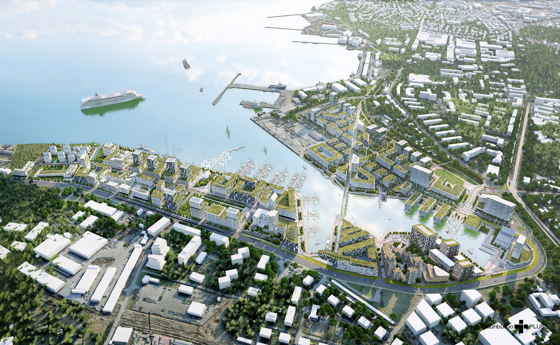
Another surprising moment for Allmann was when the team used artificial intelligence to create visual images of the digital twin. All the data of Hundipea development and analysis was fed to an AI tool that then visualized the information and created illustrations of future Hundipea. Many rules including the info on the size of houses, roads, and streets were set by PLUSS, but the appearance of all buildings was created by artificial intelligence. For example, an architect wrote which facades are promising in terms of greenery growth, and the AI took this into account.
Architects are used to the fact that most people don’t perceive architectural illustrations well and cannot imagine that a white box on a draft could look beautiful in real life. This is where AI helps a lot, giving the model a human feel and scale through innovative spatial creation without trying to be too realistic. After all, the real building will be born years later, and there is no point in limiting the thoughts of the future architect based on today’s knowledge.
The digital twin created is unique in the region. “One of the most exciting things about the process has been that you quite often realize that you are doing something that no one did before you,” Allmann admits.
The model is a big step towards making sustainable urban planning practices easy to access and will hopefully become a universal tool for urban planning globally.